-
Historia
On November 29, 1947, the United Nations General Assembly proclaimed the partition of the Land of Israel into two states: one Jewish and one Arab. The Arab side rejected the proposal, which led to the outbreak of the Israeli War of Independence. Until May 14, 1948, the conflict was fought between Arab guerrilla groups and Israeli defense forces, which were considered underground at the time. After the declaration of the State of Israel, the guerrilla warfare escalated into a full-scale war between regular armies.
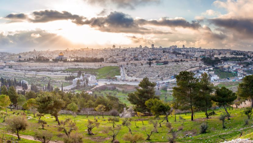
Egypt, Syria, and Jordan aimed to take control of Jerusalem. What is presented here are the scars of two historic events: the fall of Jerusalem to Jordanian forces in 1948, and the recovery of the Jewish capital in 1967, marking the climax of the Six-Day War. -
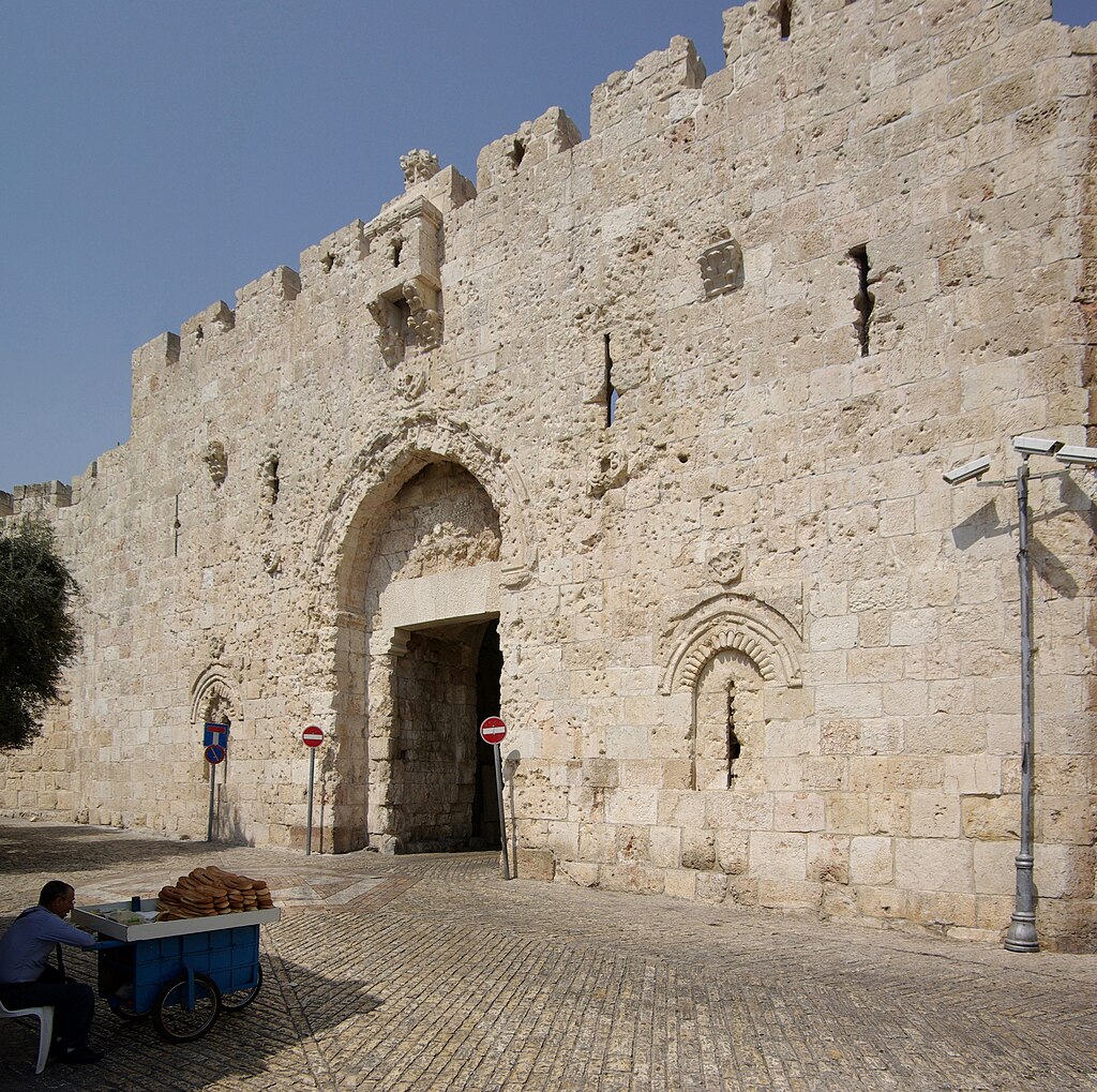 Zion Gate:
Southwestern gate of Suleiman’s wall.
Sultan Suleiman the Magnificent built these walls in the 16th century. The area we see here, located outside the walls of Jerusalem, was supposed to be included within the city limits as ordered by the Ottoman sultan. However, due to a miscalculation by the engineers, this area was left outside the walls.
Legend has it that the sultan ordered the execution of the engineers responsible for the error, and that their tombs are located at Jaffa Gate as a warning to visitors about the seriousness of disobeying the sultan’s orders.
The mysterious events that occurred at this gate, also known as the Gate of the Jews or David’s Gate, reflect the historical traces left along this path. This gate, along with the wall built in the 16th century by Suleiman the Magnificent, connects Mount Zion, left outside the city limits, with the Roman Cardo that runs through Jerusalem.
The scars marking the wall around the gate is a cruel testimony of the battles during the War of the Independence in 1948 between the newly established IDF (Israel Defence Force) and the Jordanian Army. -
 The Urban Line:
The separation line between the newly created State of Israel and Jordan from 1948 to 1967.
When Jerusalem fell to Jordanian forces in 1948, a pact was signed between Jordan and the newly established State of Israel. In that agreement, a 7 km line was drawn on a map to separate the two states, known as the Urban Line. In fact, there were two lines: a green one marking Jordan’s border and a blue one marking Israel’s border. Between them lay a space called No Man’s Land. Today, remnants of this line can still be seen throughout Jerusalem.
-
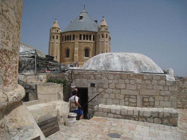 The President’s Room:
Room of Israel’s second president, Itzhak Ben Zvi, on the rooftop of the David’s Tomb complex.
During the 19 years between 1948 and 1967, Jerusalem’s Old City was off-limits to Jews. Within its walls, the Western Wall (the Kotel) was also inaccessible. For millennia, Jews had directed their prayers toward these walls, and now they were barred from entering.
To get as close as possible to the Old City, Jews would climb to this rooftop, from where the wall could be clearly seen, guarded by Jordanian Legion snipers. Three times a year, as in the days of the First and Second Temples, Jews would ascend here, even during Hanukkah, to pray facing the site of the Temple.
This unique room, located atop the complex that houses King David’s Tomb on the first level and the Last Supper room on the second, is known as the President’s Room. Here, President Itzhak Ben Zvi welcomed Jewish pilgrims during those years. A plaque also commemorates those who fell defending Jerusalem in 1948. -
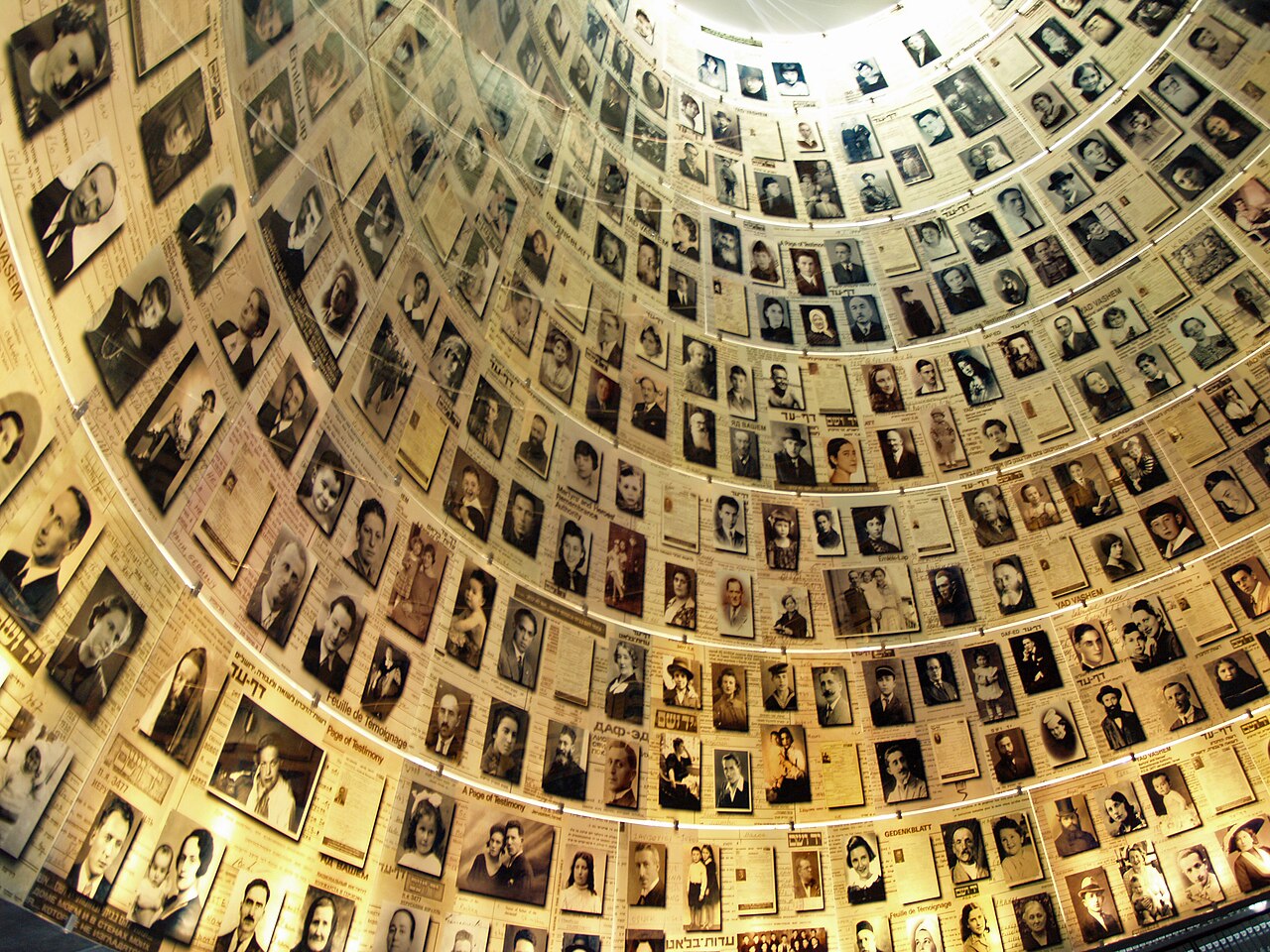 Yad Vashem – Holocaust Museum:
Founded in 1953, Yad Vashem preserves the painful memory of the genocide committed by the Nazis and their collaborators during World War II.
Built on the Mount of Remembrance (Har HaZikaron הר הזיכרון), it is connected to Israel’s national cemetery on Mount Herzl. Through its various pavilions, the museum guides visitors through the tragic journey of the Jewish people under the Nazi regime, commemorating the six million Jews murdered, including 1.5 million children, victims of the terrifying machinery of Nazism. One pavilion honors the Righteous Among the Nations (חסידי אומות העולם – Hasidei Umot HaOlam), non-Jews who helped save Jews during this dark and tragic chapter of human history.
-
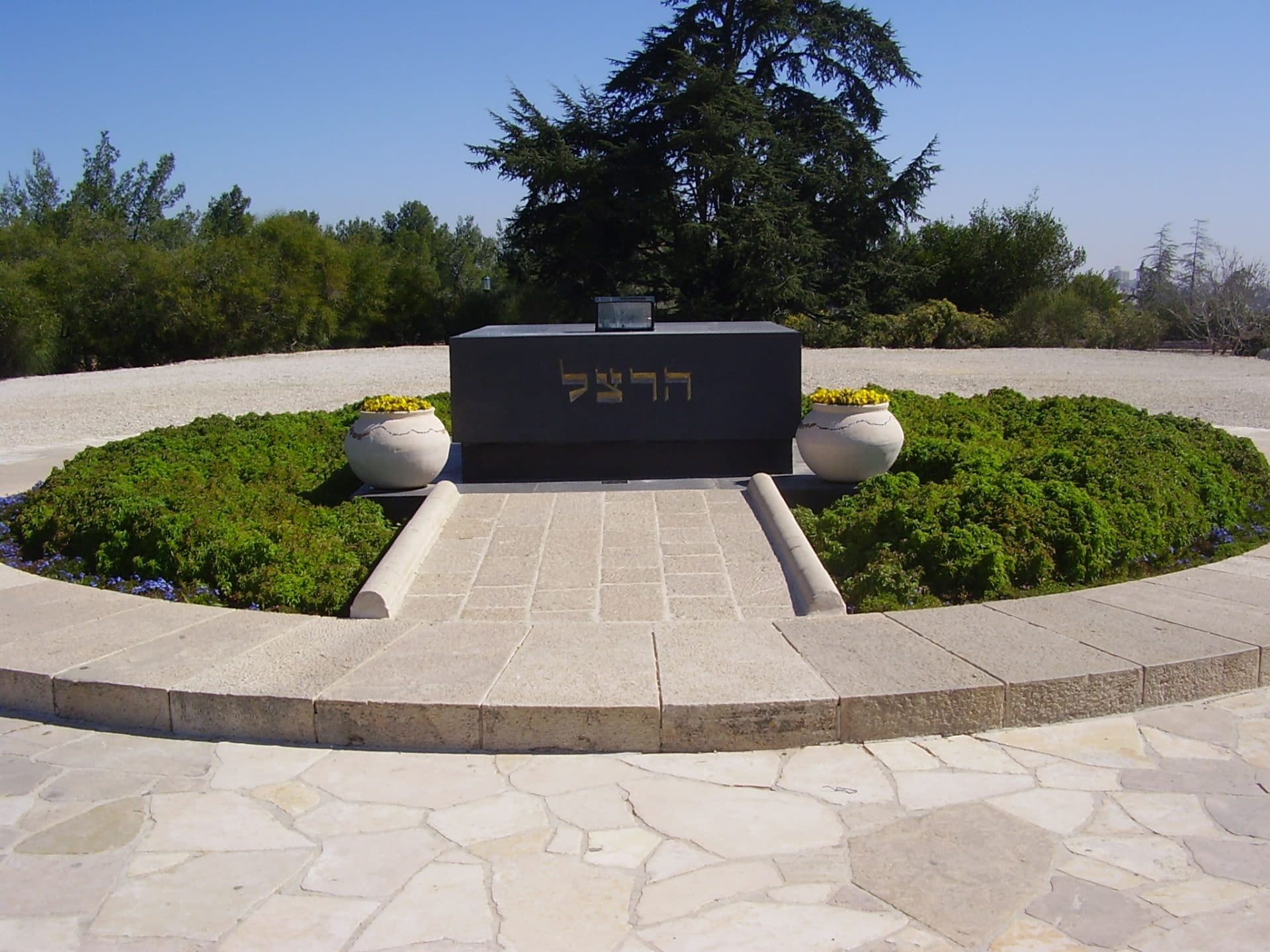 Mount Herzl:
Israel’s National Cemetery.
This mountain, also known as the Mount of Remembrance, is Israel’s National Cemetery. It includes the military cemetery and the cemetery of the Great Figures of the Jewish Nation. Walking its paths reveals the history of the Jewish people’s return to the Land of Israel: from the first victim of terrorism, the martyrs of clandestine immigration, resistance fighters, to the painful wars that continue to claim lives today.
But this place also holds hope, the same hope expressed in Israel’s national anthem, HaTikvah (התקווה), the hope to live in peace in the Land of Israel and be a "light unto the nations," as the prophet Isaiah said. That’s why, year after year, on May 14, Israel’s Independence Day is celebrated here, where tears for the fallen water the mountain’s grass.
In the photo: the tomb of Dr. Theodor Herzl, founder of the Zionist movement and visionary of the Jewish people’s return to the Land of Israel. -
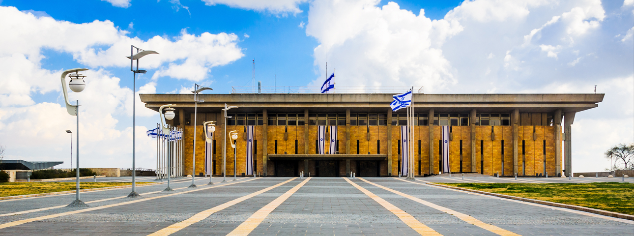 Knesset:
Parliament of the State of Israel.
Since 1966, this building has housed the 120 members who represent all communities and ideologies of the State of Israel. Israel is a parliamentary democracy, meaning the government is formed by a coalition of parties that hold more than 50% of the seats (at least 61 mandates) in the Knesset.
-
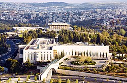 Supreme Court of Justice:
This impressive building houses Israel’s Supreme Court, the highest judicial authority and a symbol of judicial independence and the rule of law.